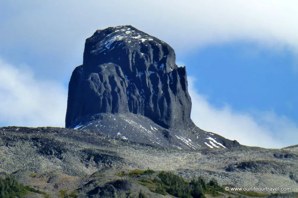
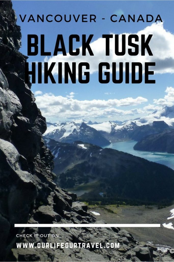
Why Black Tusk?
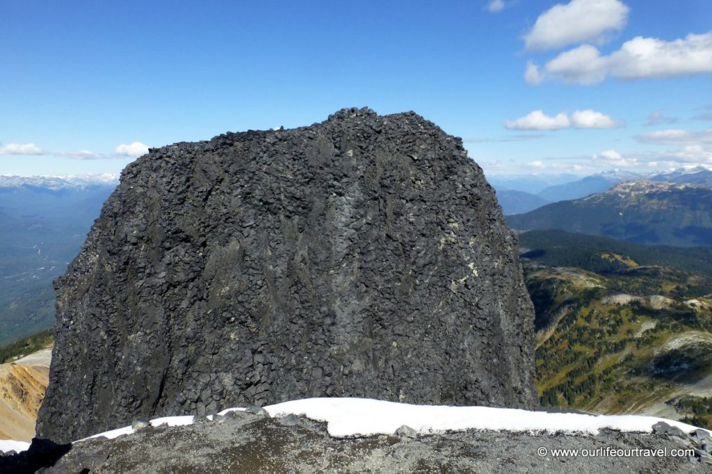
Black Tusk, like the Lions, is another very distinctive peak next to Vancouver. This one is a bit further and not visible from the city, but if spotted it can’t be mistaken with any other peak. When traveling on Sea to Sky Highway between Whistler and Vancouver you can spot it from the road. The peak is 2319 m a.s.l. This pinnacle shaped mountain is another volcano in British Columbia like Mount Baker in nearby Washington. The black volcano has its place in local mythology. For indigenous Squamish people, it is known as ‘Landing Place of the Thunderbird‘.
I wanted to climb Black Tusk since I first heard of it. When planning the hike, I initially wanted to go there by public transit, but that would add at least 5 kilometers extra to a hike that is gonna be anyway long at around 30 km. Having this in mind, I started to look for fellow hikers with a car who wanted to go for this trip. As we don’t have tents nor sleeping bags with us here, I wanted to make it as a day trip. As you can imagine many people prefer to divide the 30 km hike into 2 days and camp at Garibaldi Lake or Taylor Meadows. After a month of looking for someone who has space for me in the car and plans to do Black Tusk on one day, I was finally lucky in the end of September. Unfortunately, that day Katalin was away for her fieldwork, so she couldn’t join me and it’s a pity as it turned out to be one of the best hikes around Vancouver.
On the way to the Tusk
[sgpx gpx=”/wp-content/uploads/gpx/black_tusk.gpx”]
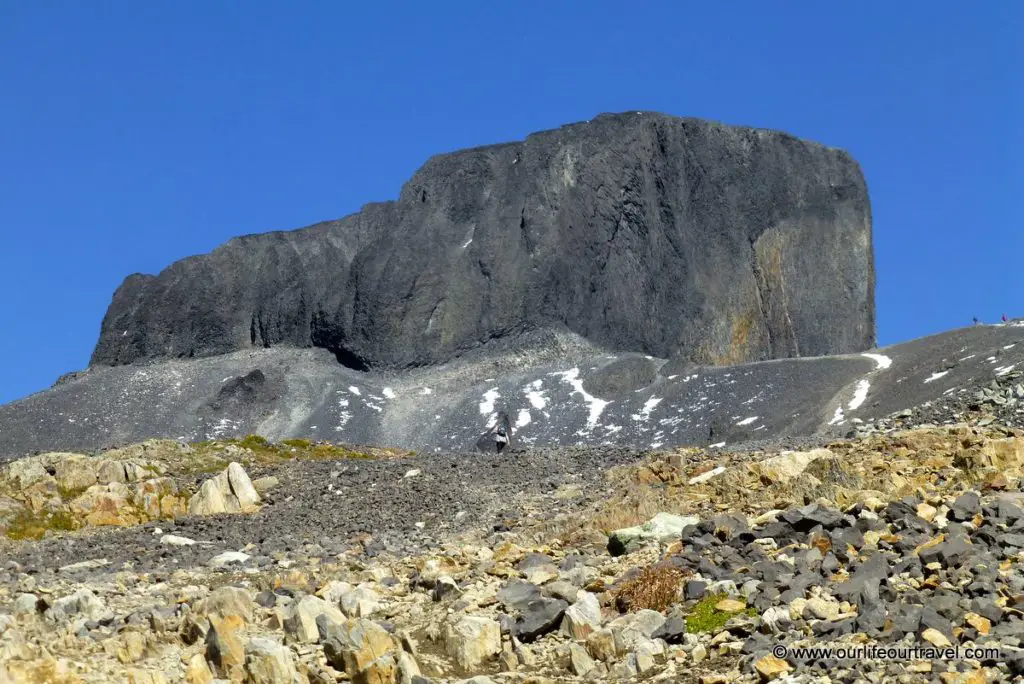
There are several approaches to the peak. There is even an option (not so official) to access a point very close to Black Tusk by 4×4 vehicle. We chose the most popular approach from Rubble Creek trailhead. This is a starting point for a trail to Garibaldi Lake that makes the way quite crowded. First 6 kilometers the trail goes through the forest with no views climbing steadily. After that, there is a junction where you should take a turn to Taylor Meadows to go out from forest soon. When you leave the forest you will see the black peak towering on your left
The views start and the trail becomes flat and you walk for quite a while on meadows with beautiful views to all directions. There are several junctions here with trails leading to Garibaldi Lake. Stick to Black Tusk trail that is clearly marked. When you reach the junction with a trail leading to Panorama Ridge (another great hike which we unfortunately missed), take left to Black Tusk. This is the place when ascending starts again.After a while, you leave the last trees behind you and reach a point with a board where official trail ends.
Beyond the trail
From here you have a really magnificent view to Black Tusk from close. The board advises you not to continue. But the best views are still ahead and the trail up to the bottom of the lava column that constitutes the peak is easy and safe hike despite what the board says. Soon after the board, scree slope starts and you keep walking on the screen until the bottom of the pinnacle. In September, not so much higher than the end of the official trail we reached snow level. Just moments later the view to the other side of Black Tusk opened up a bit and it was amazing, but not quite as impressive as what can be seen from the bottom of the tower.
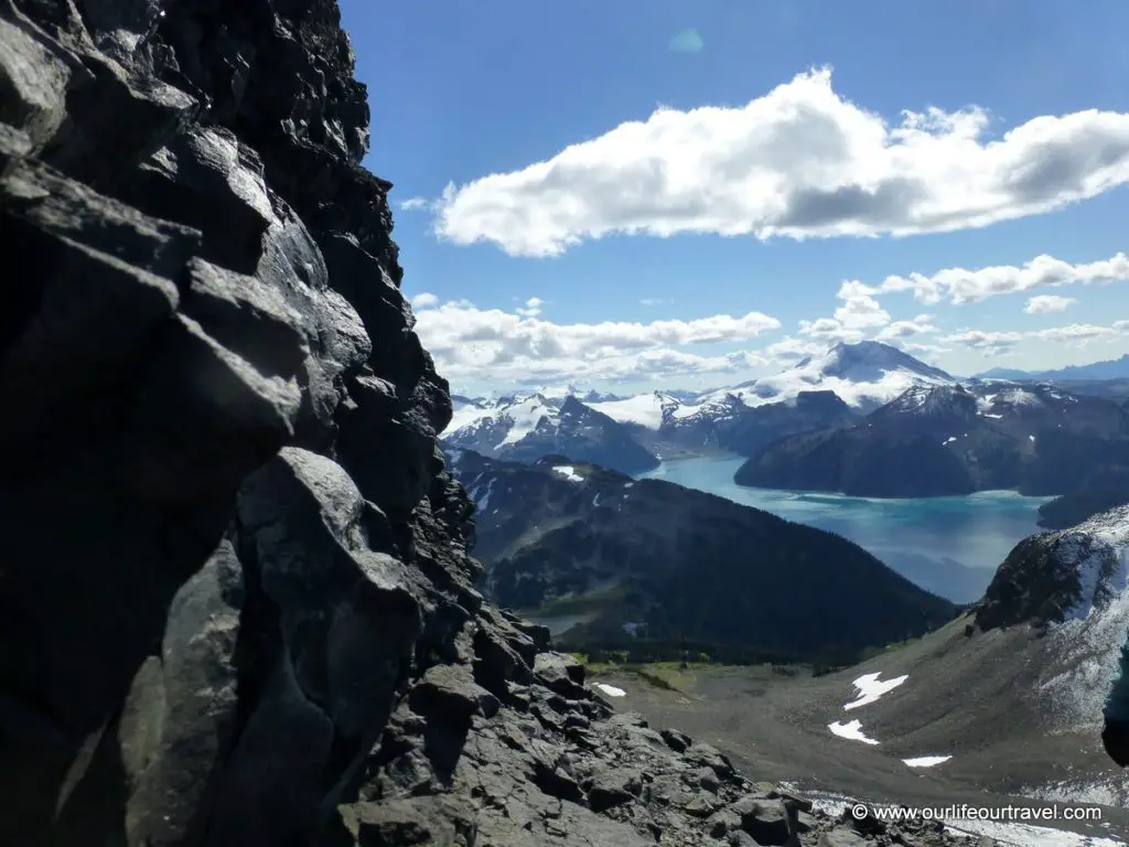
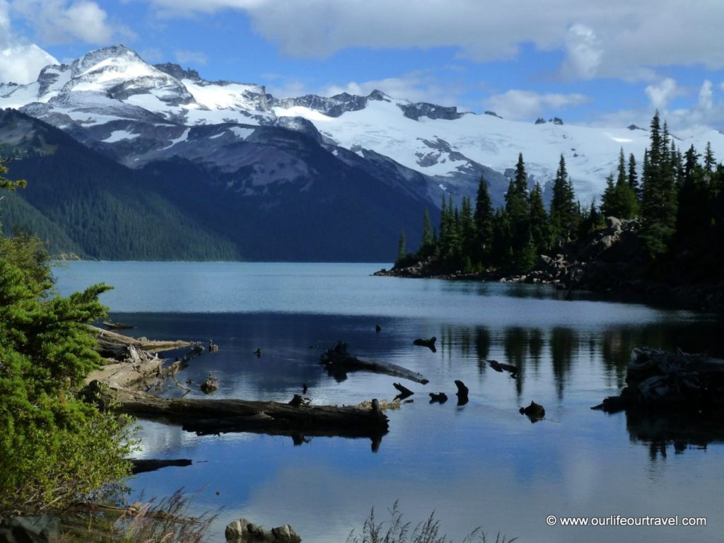
The bottom of Black Tusk offers a view to Garibaldi Lake and other mountains around that are behind you as you climb, but for me, the most stunning view was in front to the scary vertical wall of the volcano and smaller lava needles just under my feet separated by a huge abyss. This is the point where many people turn back. Here my group caught up with few hikers that we’ve been following since Taylor Meadows in some distance. They asked us if we saw grizzly bears when crossing the meadows. They noticed mother with two cubs. We didn’t see anything despite the fact we were not much behind them.
Final scramble
After enjoying the views we started scrambling the jagged peak. That was the moment when I realized how much heat comes from the black rocks. As the day was sunny, the rock was very warm. While surrounding Black Tusk it seemed there is no way up. But after a while, you will see a little chute marked with tiny orange ribbons. Actually, it’s easy to miss, but if you continue past it soon the path starts to get more difficult.The chute is more or less at the point where you turn right around the peak and is at a point from where you can see a microwave tower for the first time since reaching the bottom of the Tusk.
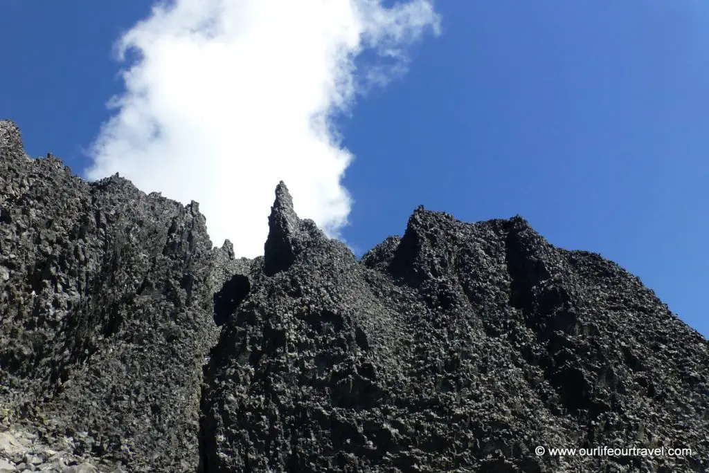
The chute looks challenging from the bottom, but it’s not that hard at all as it seems. Just remember to use three points of hold as the rocks are often loose. Also, watch out for falling rocks if there is someone in front climbing the chute. For me, it was the first scramble that gives me a bit of adrenaline in my veins what I was missing so far in Canada.
The peak(s)
The area on top of the lava column is flat and has a great view to all sides. That is the highest point climbable without equipment. The actual summit that is only about one meter higher is separated from this area by a big notch. That southern ‘peak’ is a perfect place not only to enjoy amazing vistas but also to rest lying on the warm black rock. I almost fell asleep there while enjoying the warmth. Descend down the chute to the bottom of the pinnacle isn’t more difficult than the ascent.
Famous lake
From Black Tusk we went down to Garibaldi Lake, but I wouldn’t recommend it. It makes the hiking bit longer, and the lake isn’t extraordinary. There are many better lakes like for example Wedgemount Lake. Garibaldi Lake is very popular and that makes it crowded. Also, the views are not stunning at all. The lake is big and the mountains with glaciers are far away and don’t weigh you down with their size. By avoiding the lake you avoid quite big descend too.
Hiking Info
This is truly useful, thanks.