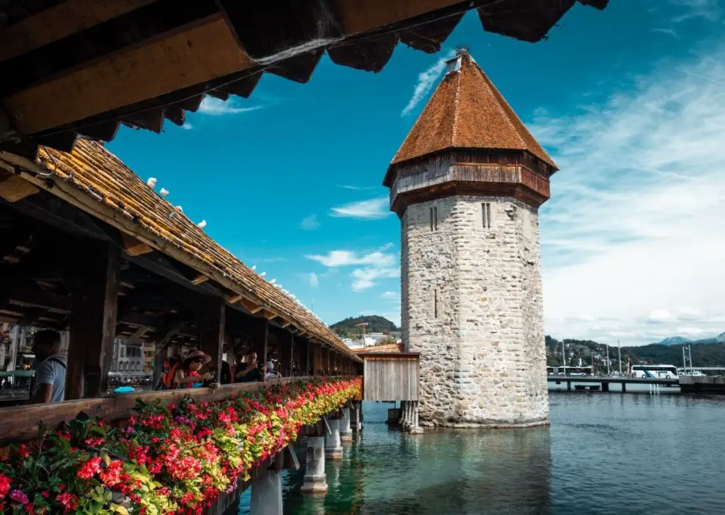
Lucerne is one of the most-visited cities in Switzerland for a good reason. It’s a city where one can enjoy all the best of Switzerland – history, culture, and heaping dose of Alpine scenery. It’s situated by the country’s fourth largest lake, Lake Lucerne, surrounded by glistening peaks all year round. There is a long list of things to do in the city, but Lucerne’s location in the heart of Switzerland makes it an amazing base for day trips and excursions.
Lucerne is beautiful and captivating, so you might actually be hesitant to wander away. But if you do get an itch to get closer to nature, here are the best hikes you can take near and around Lucerne.
Disclaimer: The post may contain affiliate links.
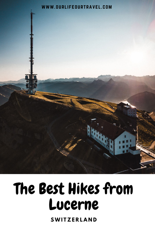
1. Easy Lucerne Hike Around The Top of Rigi
For beginners and casual hikers, Rigi is a popular destination. It’s one of the nearest mountains to Lucerne, easy to access from other cities like Zurich, and has an extensive network of trails suitable for anyone from young kids to expert hikers. Snow on the Rigi also clears up earlier than on other mountains, so it’s a great trip to do right before Summer and the crowds that go with it.
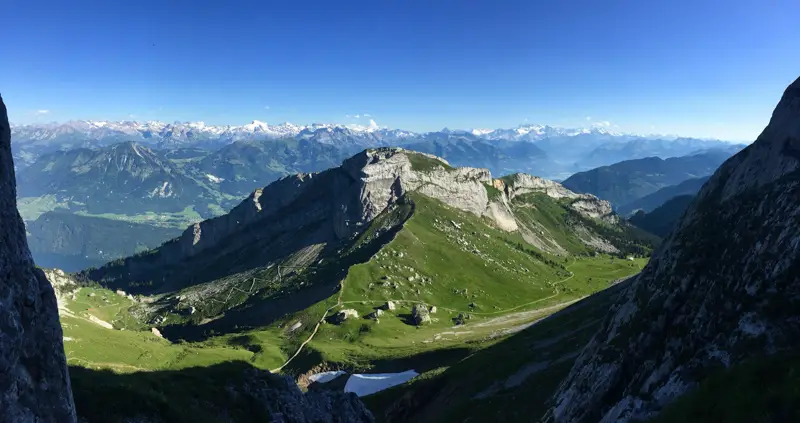
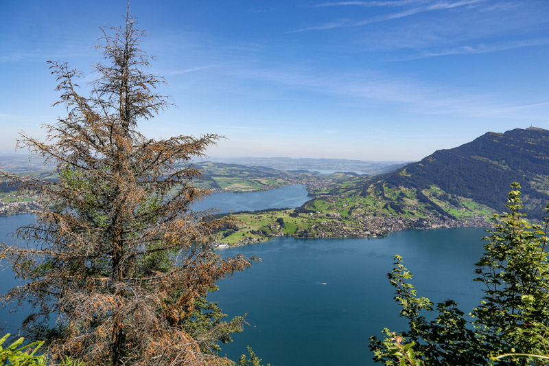
There are several trails to follow if you want to hike on Rigi. For first-timers, it’s best to take the two-hour Panorama Trail. The trail goes along the ridgeline above Lake Lucerne, giving hikers the full view of the lake and its surroundings. Right across Rigi is the luxury resort Bürgenstock, and to the right is the popular Mount Pilatus. The trail gently climbs 200 meters and ends at the junction where Rigi’s cable car connects to Goldau.
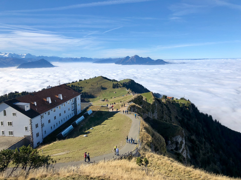
Alternatively, more advanced hikers can hike all the way to the top at Rigi Kulm. From here, the views are almost unbeatable – 360-degree aerial view of the city, the lake, and the surrounding mountains and flatlands of the North. You can reach the top on foot from the base of the mountain, but for those short on time (or effort), you can catch a train straight to Rigi Kulm and make the short hike to the top.
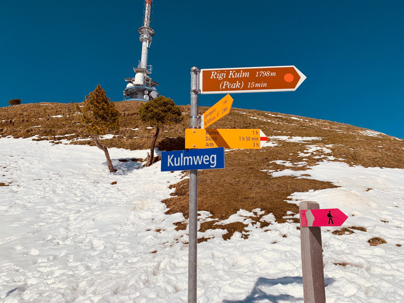
Rigi Hiking Trail Details
Hiking Time: 2hrs
Distance: 7km
Ascent: 190m
Descent: 70m
Difficulty: Easy
Starting Point: Rigi Kaltbad Station
Ticket for Rigi Cable Car
2. Mount Pilatus from Lucerne
Mount Pilatus in Central Switzerland is a popular hiking destination as it can be accessed from many different cities. As another mountain near Lucerne, this relatively easy hike sees crowds all throughout the year. The hikes start at the town of Alpnachstad and goes 8 kilometers to the top of Mount Pilatus. Regular hikers can complete the ascent in 4-5 hours. While the hike can be steep, you follow a path the whole way and there is absolutely no requirement for any difficult technical hiking skills.
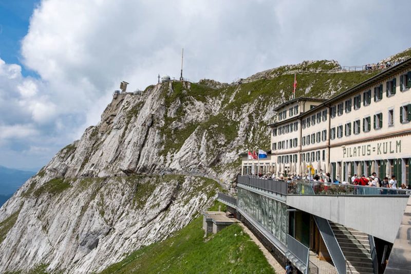
As Lucerne’s home mountain, there are several viewpoints on the way up for stunning views of the city and its surroundings. If you choose to go on foot the whole way, your hike follows the cog-wheel train in the beginning, and the path slowly opens up more the higher you get. You get stunning views almost immediately with occasional strolls through the forest.
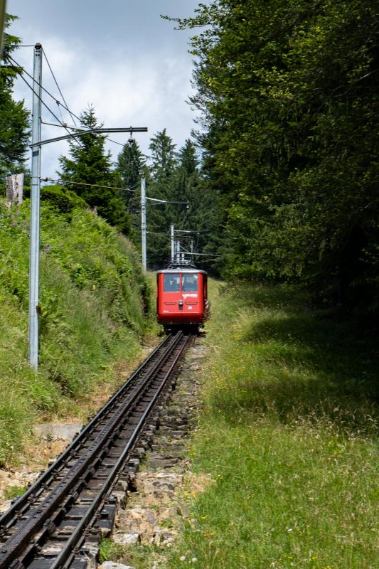
When you reach the peak at 2,073 meters, you can opt to ride the steepest cog-wheel train in the world back down to Alpnachstad. With a 48% incline, it makes for an interesting ride down (or up!).
You can find more info about Mt Pilatus trip options here!
Mount Pilatus Lucerne
Trip time: half a day
Hiking Time: 30 minutes
Trip from Lucerne to Mount Pilatus
Cost: cable car round trip from Kriens to Pilatus Kulm: adults CHF 72, children 6 to 16 CHF 36
3. Bürgenstock and Hammetschwand Lift
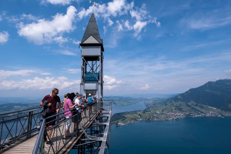
If you’re prone to vertigo, then you might want to skip Europe’s one-hundred-year-old elevator at Bürgenstock. The Hammetschwand Lift is one of the best ways to view Lake Lucerne, 152.8 meters high up in the air. The lift first opened in 1905, which took a full three sluggish minutes to reach the top. Now, it only takes a minute to get to the highest vantage point around Lucerne. The first 14 meters of the lift is encased in the rock against where the lift is built.
There are several ways to reach the lift. In the summer, you can take any of the three boats that leave Lucerne to Kehrsiten-Bürgenstock or follow the Felsenweg path, also known as the Bürgenstock cliff walk. There are well-marked paths and will take around half an hour to reach the lift. The path is not difficult, but it’s rugged and rocky and will require different levels of fitness. It’s carved into the side of the cliff so the views from this hike are nothing short of amazing. There are also many fences and barriers to ensure the safety of the path, so older children are able to do this hike.
As an alternative, you can take a funicular rail from Lake Lucerne to Bürgenstock, or take a pre-booked bus from Stansstad to Bürgenstock.
Bürgenstock and Hammetschwand Lift & Sightseeing
Total time for the trip: 2-4 hours
How to get there:
By boat: from Lake Lucerne to Kehrsiten-Bürgenstock (summer only)
By lift & hiking: via the Felsenweg path to the valley station of the Hammetschwand lift (summer only)
By funicular rail: from the lake to the Bürgenstock,
By small bus from Stansstad to the Bürgenstock - pre-bookings required
4. Fronalpstock Panorama Trail
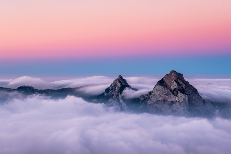
The Fronalpstock Panorama Trail is a great hike to take with your children, especially if you have an all-terrain pram. The fun begins riding the world’s steepest funicular to the car-free resort town of Stoos with an altitude of 1,300 meters. From here, you take a chair lift to Fronalpstock station, reaching 1,922 meters in altitude. Needless to say, the views from this vantage point are amazing. The glistening Lake Lucerne is in full view, but several surrounding lakes can also be seen from this point. Next to the lakes are the many peaks of Central Switzerland that accompany you throughout the comfortable hike of the Panorama Trail.
The trail is only 1.5 kilometers long. The path is wide and relatively flat. The trail naturally loops back to the Fronalpstock chair lift station, but there are several ways to make the hike challenging.
At the end of the Panorama trail, instead of looping back to the station, you can continue on to the connected Moor Theme Trail. It’s meant for children but just as fun for adults with stations, games, and activities along the way about the Moor.
Another way to make the hike more challenging is to take the Klingenstock-Fronalpstock Ridge trail, which is like an expanded version of the Panorama trail. It’s 4.4 kilometers long. The trail is narrower than the Panorama trail and there are several steep drop-offs and stairs. However, it’s not so difficult that older children can’t handle it, so it is still a good family trip to take.
Fronalpstock Panorama Trail Details
Distance: 1.5 km
Time: 1 hour
Difficulty: Easy
5. Multi-Day Hiking: Waldstätterweg trail
The Waldstätterweg trail is a flexible trail that can be mixed in with boat, bus, or train rides. It’s a cultural walk with a historical element, and, with its connection to the Swiss Path, circumnavigates the whole of Lake Lucerne.
The Waldstätterweg trail goes in seven stages, each stage taking anywhere between 4-6 hours to complete. The whole trail will take 46 hours non-stop on foot, but trip times can be cut short through buses or boat rides in between stages. Whichever part you take on the trail, the main draw is its proximity to the lake – you walk right by the lake the whole time. Taking this trail brings you through all the hiking areas in this list, with the city of Lucerne as a reference point. The trail takes hikers through the main towns around the lake, the flanks of the Rigi, and the Burgenstock which is the trail’s highest point.
Some parts of the path follow historical trails while other parts are new to complete the route. All in all, however, the Waldstätterweg trail follows the journey of ancient Switzerland that shows how the first tourists arrived in Central Switzerland, the importance of agriculture in the region, and which ancient traditions still stand true to this day. For a more meaningful hike, visitors can go on the Lernen Unterwegs (Learning along the way) for thematic, self-guided tours distributed around the lake.
Waldstätterweg trail
Time required for whole trail: 7 days
Whole Distance: 115 km
Ascent/Descent: 4800 m
Time for sections: 4-6 hours
Where to Stay in Lucerne
On a budget: in the modern yet cheap capsule hotel lucerne at the heart of the city
Mid-range: 3 km away from the center at Holiday Inn Express
Splurge: in the self-serviced Hirschenplatz Apartments or in the luxurious Hotel Schweizerhof
Travel Resources
There is nothing better than a relaxed holiday. To ensure your rest, make sure you reserve and book your accommodation and transportation in advance of your trip.
- Book a small group of private tours with us at amazinglapland.com to make your experience magical in Lapland.
- Don’t forget to insure yourself during your travels: SafetyWing. Check out their policies HERE. It also covers several virus-related expenses.
- Look for the best prices on flight tickets, hotels, and car rentals: Expedia
- Car rental: SIXt
- Accommodation: Booking.com, Agoda or Hostelworld if you travel on a budget. Don’t forget that you can search for Apartments also on Booking.
- Activities: GetYourGuide
- Opinions on hotels and restaurants: TripAdvisor
- Was your flight canceled or delayed? Get up to 600€ back with the help of Compansair!
About Anna – Guest Author
Anna was born to travel the world having studied languages all her life. Although she has traveled the world, she now calls Switzerland home and spends her time writing about her experiences on Expert World Travel. You can follow her on Facebook, Twitter, and Pinterest.
Photos: Unsplash, Our Life Our Travel, Expert World Travel
Great post! Spending all summer at home, I did a lot of hiking and also did dome of the ones you mention in your post. The cliff walk from Fronalpstock to Klingenstock is my favorite! 🙂
What a wonderful area you grew up in!